gryllosblog Gryllo's (aka Ian Lewis') blog. All things to do with travel, wildlife especially birds, history, architecture and anything else that interests me.
The previous post covered our journey from Wexford to Belfast. This time our journey continues along the coasts of Co Antrim, Co Derry and Co Donegal.
Up to now the weather on the trip had been a bit indifferent, often overcast and dull but as we headed north out of Belfast the sun shone and we had wonderful views.
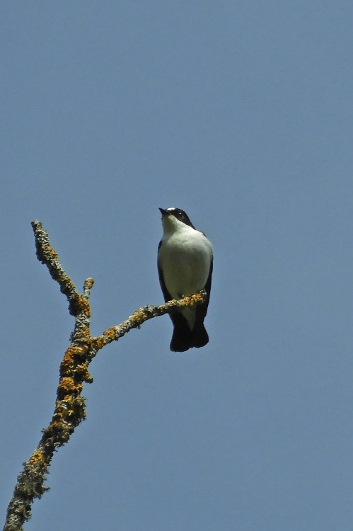
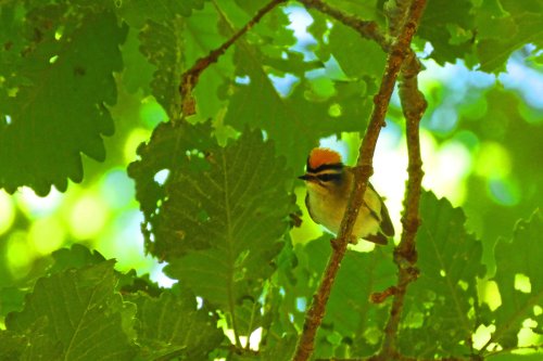
Along the coast we saw a few birds typical of rocky shoreline such as this Rock Pipit.
We paused at the village of Glenarm …
… where we were so close to Scotland that the Kintyre peninsula dominated the view.
Some cloud rolling in at times but mostly it was blue skies.
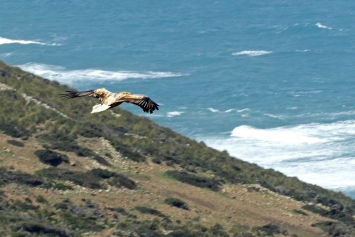
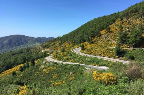
It was just a whim that took us on the scenic Torr coast road but we were very glad we did. The single track road was steep, narrow and winding but the views were superb.
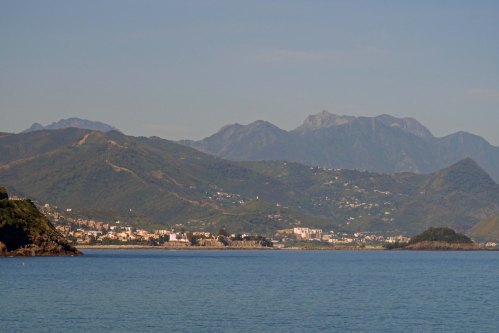
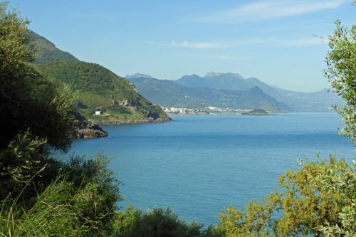
As we turned the corner and drove westwards rather than northwards the Kintyre peninsula fell behind us and Rathlin Island appeared on the horizon. Further in the distance we could see the Scottish island of Islay and the Paps of Jura.
We stayed in the pleasant town of Ballycastle. The following day we took the ferry to Rathlin Island (above).
On arrival we joined a tour bus which climbed out of the village and took us to the far west of the island …
… where in an area of rugged coastline …
where an RSPB reserve protects a major seabird colony.
Kittiwakes built their nests on the precipitous cliffs …
… these delicate gulls have declined drastically due to global warming and over fishing (for fertiliser) affecting their sand eel food supply.
Fulmars, which are relatives of albatrosses and shearwaters rather than gulls, were present in good numbers.
The less steep slopes held good numbers of Razorbills …
… joined by Puffins, which nest in burrows that they dig wherever there is exposed soil.
The turbulent waters far below held enormous numbers of auks and many, like this Guillemot, were seen flying back and forth to the colony.
Around 100,000 seabirds nest on the reserve and Guillemots are by far the most numerous. We also had views of of Northern Ireland’s rarest breeding seabirds, the Great Skua (or Bonxie to give it the name used by most birders) with just one rather distant pair present.
Back at harbour we went for a walk along the shore, seeing good numbers of Grey Seals …
… and Common Eiders. Male Eiders loose their breeding finery in the later spring so we were fortunate to find one in breeding plumage this late in the season.
Under increasingly grey skies we returned to the mainland were it rained for the rest of the day.
The next day the weather had improved but the forecast wasn’t good so we left early and headed to Carrick-a-Rede. Situated on the coast with the western end of Rathlin Island visible in the background, one of the small offshore stacks is connected to the mainland by a narrow rope bridge.
Actually we got there too early, the ticket office was closed and when it did open we found an entire bus of school kids had pre-booked tickets and would be ahead of us. As only four people are allowed on the bridge at once we realised that this would cause us a huge delay.
I had visited the site before in 1991 and Margaret wouldn’t dare cross a chasm like this so we decided to just admire and photograph the bridge from the nearby coast path.
From here we carried on to the Antrim’s coast’s prime attraction, Giant’s Causeway – a World Heritage Site …
… formed by the slow cooling of a underground dome of magna that was extruded at the time when the Atlantic opened up some 60-70 million years ago, the basaltic columns and hexagonal ‘tiles’ are truly a wonder of the world.
The site is of course the same as it was in 1991, but the access is very different. Whereas before you just parked and walked down now there are high charges, big carparks, busses to take you the half mile or so to the site and of course the inevitable enormous visitor centre complete with gift shops, cafés etc.
Our third site of the morning was the so called ‘Dark Hedges’, an avenue of twisted beech trees that line the access road to a private estate. The sight would be worth seeing in its own right, but now of course, has become part of the Games of Thrones locations trail. The spot (which was used as the point on the King’s Road where Arya Stark met the Brotherhood Without Banners) has been closed to traffic but that didn’t stop loads of cars and even coaches stopping by the entrance and causing traffic chaos rather than using the dedicated car park at the nearby hotel.
We headed west towards Londonderry, or just Derry depending on your political and religious convictions and almost immediately the forecasted rain arrived. We arrived mid-afternoon and soon found a hotel (with dedicated underground parking) that overlooked the infamous Bogside. In past times the predominately Protestant inhabitants of the City of Londonderry prevented Catholics from living within the city walls (shown above). As a result they had to live next to marshy ground by the River Foyle. This became known as the Bogside.
Barricaded against the police and military at the start of the Troubles and the scene of the infamous and inexcusable Bloody Sunday massacre, this area was considered a no-go area for tourists during much of the thirty year period of sectarian violence. In 1991 Janet and I parked nearby and walked down to this huge sign however we felt that going any further as risky.
Now 28 years later we strolled through the streets (in heavy rain) looking at the Bloody Sunday memorial, the massive murals on the end of the terraced rows We also tried to visit the Free Derry Museum but it was closing as we arrived.
… and even had a pint in the Bogside Inn, something that wouldn’t have been advisable on our last visit..
Although I cannot condone violence from any organisation, be it Republican or Unionist, I have always felt that the Catholics of Northern Ireland were made to be second class citizens in their own country. Perhaps the most shocking event of the ‘Troubles’ was the Bloody Sunday massacre on 30th January 1972 when British troops opened fire on protesters killing 14 and wounding a similar number. There were various inquiries into the tragedy but the last in 1998, which took 12 years to report, concluded that that ‘the killings were both “unjustified” and “unjustifiable”. It found that all of those shot were unarmed, that none were posing a serious threat, that no bombs were thrown, and that soldiers “knowingly put forward false accounts” to justify their firing’. It was certainly the case that this event served to stoke the flames and probably escalated the sectarian violence more than any other.
Since the Good Friday Agreement in April 1998 peace has returned to Northern Ireland and the Peace Bridge across the River Foyle has been erected to commemorate that.
The following morning we returned to visit the Free Derry museum. Later we crossed back into the Republic and (perhaps surprisingly) headed north. We drove to Malin Head, the northernmost point of Ireland, which in fact is not in Northern Ireland but in ‘Southern’ Ireland (or Eire if you prefer.)
There was hardly anybody about, in spite of it being June it was cold and wet and the roads and glorious beaches were deserted …
… and the coastal path almost so.
Donegal is bisected by a number of long sea loughs …
… some can be crossed at their headwaters by bridges, others require a long detour.
The area is almost entirely Gaelic speaking and in spite of modern navigation aids we had difficulty finding our B&B. However once there the view from our room was wonderful and we were serenaded by a reeling Grasshopper Warbler each evening.
Nearby was the spectacular Glenveagh National Park.
A wild area of mountains, moorland and abandoned villages.
I was interested in seeing the reintroduced Golden Eagles but I found out at the visitor centre that this would involve travelling quite a long way into the park and we really didn’t have the time.
West Donegal is comprised of quiet beaches …
… and quaint villages with tongue twister names …
… with the mountains of Glenveagh National Park as an ever present backdrop.
This impressive peak was photographed from near the village of Magheraorty, the location of the ferry to Tory Island. Today was the day we had allocated for Tory Island but we so nearly missed out. The day before we had checked the departure time and found it to be 1000. We left the B&B about 0815 but stopped a few times on route to take photos. We arrived just on 0900 when Margaret had the good sense to phone the ferry office to check that the boat was going. We found out to our shock that it was departing at 0900 and whilst she was still the phone, the boat cast off and pulled out. I was ready, so I ran down the pier and to my surprise the boat reversed and pulled back in. Margaret who still had to put her boots on was a little later but they waited for her. Fishermen on the pier made disparaging comments ‘like don’t hurry love, you’ve got plenty of time’ or ‘I’ll take you over there for half price’.
Tory Island is further than Rathlin from the mainland and the crossing took about an hour. You may wonder why the island shares its name with our current ineffectual government and the answer is stranger than you might think. Tory is derived from the Gaelic toraidhe meaning outlaw, robber or brigand. Tory Island must have been home to such in the past. In 1685 during the reign of James II the Conservative Party opposed the ‘exclusion’ of Charles II as his successor (he was to be excluded on the grounds that he had converted to Catholicism). The Whigs who had proposed the ‘exclusion’ nicknamed them Tories and the name stuck. I like the idea of Boris, Rees-Mogg and Gove being named after outlaws.
When we landed on Tory Island it was like a ghost town, there was no-one to be seen. We later found that they all had gone to mass, which would explain the presence of a priest on board the ferry and why the ferry had departed an hour earlier than expected.
Around the harbour were a reasonable number of Common Gulls. These rather cute medium-sized gulls aren’t common at all and probably derive their name from their plain appearance rather than their numerical situation.
A bird I really wanted to see was the Corncrake. Quite a few exist on Tory Island (although they are scarce on the mainland). I heard about half a dozen calling but I totally failed to see anything, not even a twitch in the nettle beds from where they were calling. I took this photo in the Outer Hebrides in 2012 where I had rather more luck.
However if you want to hear what these wonderful creatures sound like then click on this link to the bird sound library of xeno-canto.
We set off for a walk to the west end of the island. Much of the area was marshy with many ponds and was full of breeding waders.
As well as breeding Redshanks (above) we saw Dunlin, Ringed Plovers, Lapwing and even a ‘drumming’ Snipe, ie one in display flight, something I haven’t heard/seen for years.
After some lunch in the local pub we returned to the harbour of the boat back to Magheraorty. From here we drove south to Sligo where we stayed overnight.
I’ll conclude this post with a photo of some female Eiders and ducklings in the harbour of Tory Island.
The next post will cover Co Sligo, Co Mayo, Co Galway and the Aran Islands, the return to Dublin and the Isle of Man.
I visited Ireland with my parents in the 60s and again with my late wife Janet in the 90’s, however Margaret had never been and was keen to rectify this. We had planned to visit in June/July 2018 but I had to have an operation so that idea was postponed. So although there were a lot of travel commitments in spring 2019 we managed to fit in a trip to Ireland as well.
Originally we planned to circumnavigate Ireland, but the more we investigated the more places of interest we found, so we decided to cover around two thirds of the coastline and return in another year for the rest. Also on my Mongolia trip 2018 I met a nice couple from the Isle of Man who invited us to look them should we ever visit. So as neither of us had visited the IoM we added that to the itinerary.
We decided to take our own car rather than fly and took the ferry from Pembroke in south Wales to Rosslare in the southeast corner of Ireland.
The ferry left Pembroke in the afternoon, travelling down the enormous Milford Haven to the Irish Sea.
We passed a number of bird rich Islands including Skokholm, famed for its seabirds including a large Manx Shearwater colony …
… and the huge Gannet colony of Grassholm island. The white appearance of the island is produced by tightly packed nesting Gannets and not some light coloured rock.
After landing we stayed in a B&B at nearby Kilrane. The following morning we headed to Our Lady’s Island, a site of pilgrimage for catholics.
However we weren’t here for the ruins or the pilgrimage but to see the birds. Our main target was Roseate Tern, but all the tern colonies along the side of the lake were composed of Sandwich, Common and Arctics and not their rarer cousins.
At the south end the lake is separated from the sea by a shingle bank, hundreds of terns were flying over the bank and heading out to sea to fish.
Eventually we saw half a dozen or so Roseate Terns. Identified by their paler appearance, rosy flush to the breast in breeding season, darker wedge in the outer primaries and black bill with a red base, their population has declined markedly in the UK but there are still around 700 pairs breeding in Ireland. I didn’t manage to photograph these fast moving birds so here is a photo taken from eBird (photographer’s name not given).
We also visited the nearby Tacumshin lake, a site famous for rarities, in particular North American shorebirds in the autumn. Although there were quite a few birds they were all too distant for photos. We had lunch in Wexford at a pub that had converted the ally out back into an elegant covered lounge.
Margaret wanted to visit the Irish National Heritage Centre; we had hoped it would be an exhibition of arts and crafts and maybe music; instead it was a recreation of dwellings from various times in the past, the Mesolithic, Neolithic and early Christian eras with boards explaining what life was like in those periods, which was interesting in its way, but not what we had expected.
We continued northwards to Arklow and stayed by the banks of the Avoca River …
… at the predictably named Bridge Hotel.
We were travelling up the east coast on our way to Dublin. Today we headed into the Wicklow Mountains, but it wasn’t the best mountain experience I’ve ever had. Although the scenery was pretty they were hills rather than true mountains and allthough there were a few good views there was nowhere to park and photograph them.
A quaint village with an old church and an unusual tower was a nice place for lunch.
During the afternoon we drove up the motorway to Dublin. We had thought about finding somewhere to stay in the outskirts and getting the bus in but before we knew it we were in the centre. Finding a hotel was a nightmare as there was nowhere for me to park outside whilst Margaret went in to check rates and availability. All the ones we tried were either 250 Euros a night or over pubs and already full. Eventually we found a hotel that only charged 90 Euros a night but I had to drop Margaret off and then go round the block again and again until she emerged with the details.
Once settled, we found the hotel a very nice place to stay and quite central for sightseeing. That evening we walked to O’Connell Street, photographed the General Post Office (GPO), the site of the famous 1916 Easter Uprising, and the new gleaming spire before having a meal nearby.
From Wikipedia: During the Easter Rising of 1916, the GPO served as the headquarters of the uprising’s leaders. It was from outside this building on the 24th of April 1916, that Patrick Pearse read out the Proclamation of the Irish Republic. The building was destroyed by fire in the course of the rebellion, save for the granite facade, and not rebuilt until 1929, by the Irish Free State government. An original copy of the Proclamation of the Irish Republic was displayed in the museum at the GPO. The museum was closed at the end of May 2015 and replaced by a new visitor centre to commemorate the 1916 Rising, ‘GPO Witness History’, in March 2016. The building has remained a symbol of Irish nationalism.
Out first destination today was Trinity College just the other side of the River Liffey …
… we walked through the pleasant quadrangles …
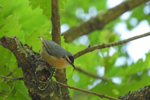
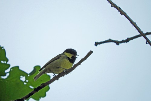
… pausing to photograph a Mistle Thrush on route.
Of course what we wanted to see was the wonderful Book of Kells, Ireland’s most important and most treasure historical artefact. Hardly surprisingly the actual manuscript is kept in a darkened room in the college library where photography is strictly forbidden but examples of the highly decorated pages can be seen on illuminated panels in the gallery beyond.
For those wanting a detailed description the following is (again) taken from Wikipedia : The Book of Kells is an illuminated manuscript Gospel book in Latin, containing the four Gospels of the New Testament together with various prefatory texts and tables. It was created in a Columban monastery in either Britain or Ireland and may have had contributions from various Columban institutions from both Britain and Ireland. It is believed to have been created c. 800 AD. The text of the Gospels is largely drawn from the Vulgate, although it also includes several passages drawn from the earlier versions of the Bible known as the Vetus Latina. It is a masterwork of Western calligraphy and represents the pinnacle of Insular illumination. It is also widely regarded as Ireland’s finest national treasure. The illustrations and ornamentation of the Book of Kells surpass that of other Insular Gospel books in extravagance and complexity. The decoration combines traditional Christian iconography with the ornate swirling motifs typical of Insular art. Figures of humans, animals and mythical beasts, together with Celtic knots and interlacing patterns in vibrant colours, enliven the manuscript’s pages. Many of these minor decorative elements are imbued with Christian symbolism and so further emphasise the themes of the major illustrations. The manuscript today comprises 340 leaves or folios; the recto and verso of each leaf total 680 pages. Since 1953, it has been bound in four volumes. The leaves are high-quality calfvellum; the unprecedentedly elaborate ornamentation that covers them includes ten full-page illustrations and text pages that are vibrant with decorated initials and interlinear miniatures, marking the furthest extension of the anti-classical and energetic qualities of Insular art. TheInsular majuscule script of the text itself appears to be the work of at least three different scribes. The lettering is in iron gall ink, and the colours used were derived from a wide range of substances, some of which were imported from distant lands. The manuscript takes its name from the Abbey of Kells, which was its home for centuries. Today, it is on permanent display at Trinity College Library, Dublin. The Library usually displays two of the current four volumes at a time, one showing a major illustration and the other showing typical text pages. The entire manuscript can be viewed on the Library’s Digital Collections Repository.
We also had the chance to look at the main hall of wonderful college library.
We also wandered along the banks of the Liffey admiring the architecture of the bridges, both and old and new …
… and the City Hall.
Near there was a series of sculptures illustrating the victims of the Great Irish Famine of 1845-1849. The near total failure of the potato crop due to blight, caused the death of over a million and forced even more to emigrate. The population of the country fell by 25%. The lack of support from Westminster at the time exacerbated tensions between Ireland and UK, the affects of which can still be felt today.
Later we made our way to the area known as Temple Bar …
… after the eponymous watering hole.
Nearby we had our lunch serenaded by an Irish folk group.
Further along the river we came to Ha’penny bridge, so called because that was the toll to cross it when it was built.
Quite a beautiful structure …
… the nearby inn bears the same name.
Further west we visited the Viking Museum from which you get a good view of the adjacent cathedral …
… which of course was our next port of call.
During the evening we returned to Temple Bar to eat. The area as now much livelier with musicians and competitions of strength to entertain the passers-by. Most of the bars were so crowded that you hardly get in the door so after finding an al-fresco bar we returned to the hotel.
The next morning we left the city via an underground motorway that leads straight from the docks north to motorway to Belfast. Our destination was Ireland’s most important archaeological site, Newgrange. Again it is easier for me to copy and paste from Wikipedia than type the whole lot out. Newgrange is a prehistoric monument in County Meath, Ireland, located 8 kilometres (5.0 mi) west of Drogheda on the north side of the River Boyne. It is an exceptionally grand passage tomb built during the Neolithic period, around 3200 BC, making it older than Stonehenge and the Egyptian pyramids. The site consists of a large circular mound with an inner stone passageway and chambers. Human bones and possible grave goods or votive offerings were found in these chambers. The mound has a retaining wall at the front, made mostly of white quartz cobblestones, and it is ringed by engraved kerbstones. Many of the larger stones of Newgrange are covered in megalithic art. The mound is also ringed by a stone circle. Some of the material that makes up the monument came from as far away as the Mournes and Wicklow Mountains. Newgrange consists of approximately 200,000 tonnes of rock and other materials. It is 85 metres wide at its widest point. After its initial use, Newgrange was sealed for several millennia. It continued to feature in Irish mythology and folklore, in which it is said to be a dwelling of the deities, particularly The Dagda and his son Aengus. Antiquarians first began its study in the seventeenth century, and archaeological excavations took place at the site in the years that followed. Archaeologist Michael J. O’Kelly led the most extensive of these and also reconstructed the frontage of the site in the 1970s, a reconstruction that is controversial and disputed. Newgrange is a popular tourist site and, according to the archaeologist Colin Renfrew, is “unhesitatingly regarded by the prehistorian as the great national monument of Ireland” and as one of the most important megalithic structures in Europe.
I can add that the reconstruction of the frontage by O’Keely is controversial because it is claimed that Neolithic people would not have had the technology to construct a wall of that height at such a steep angle. There has been much debate about the meaning of the spirals inscribed on the megalith by the entrance. As those on the left are coiled in a different direction to those on the right it has been suggested that this marks the movement of the sun before and after the winter solstice.
Also from Wikipedia: There is no agreement about what the site was used for, but it is believed that it had religious significance. Its entrance is aligned with the rising sun on the winter solstice, when sunlight shines through a ‘roofbox’ and floods the inner chamber. Several other passage tombs in Ireland are aligned with solstices and equinoxes, and Cairn G at Carrowkeel has a similar ‘roofbox’. However some claim that although this might have been its original intent, the current positioning of the stones is due to the 1970s reconstruction. To get a ticket to see this wonderful alignment on the shortest day you can enter a lottery and pray, not only that your name will be drawn, but also that dawn on the 21st of December will be cloud free. Photo from the Irish Times taken at the winter solstice..
Nearby was the location of a most significant Irish event. The Battle of the Boyne a battle in 1690 between the forces of the deposed King James II of England and those of the Dutch King William of Orange who, with his wife Queen Mary (his cousin and James’s daughter), had acceded to the British Crown in 1689. The battle took place across the River Boyne close to the town of Drogheda in the Kingdom of Ireland and resulted in a victory for William. This turned the tide in James’s failed attempt to regain the British crown and ultimately aided in ensuring the continued Protestant ascendancy in Ireland and that of a Protestant Monarch in Britain.
We continued north but rather than head straight to Belfast we detoured to cross the border in South Armagh. Anyone who was around in the 70s, 80s and 90s will remember the constant run of bombings and shooting from what was then ‘bandit country’. Now we didn’t even know we had crossed the border until we noticed a sign saying ‘speed limit in miles per hour’. In fact we crossed into Northern Ireland back into the Republic and back into Northern Ireland again with less hassle than it takes to use a pedestrian crossing. The fact the sort of armed border posts that I encountered in my 1991 visit could soon return if we have a no-deal Brexit fills me with apprehension. The is the town of Armagh, famous for having two cathedrals, one Protestant and one Catholic both called St Patrick.
We headed towards the huge Lough Neagh which sits in the centre of Ulster; from the south the northern shore was only visible through my scope. We called in at Oxford Island nature reserve which was far better than I expected …
… with loads of hirundines including a huge House Martin colony …
… and some excellent close views of Barn Swallows …
… Great Crested Grebes with stripy young on their back …
… and Little Grebes, their diminutive cousins …
… plus lots of wildfowl, Tufties, Pochard and this drake Gadwall.
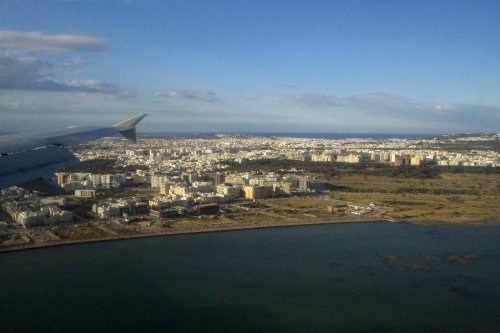
We would have liked to visit the centre of Belfast but we doubted if we had the time, so we headed towards the old docks, the site of the former shipbuilders Harland and Wolff, whose giant gantries Samson and Goliath dominate the city skyline. Once employing 35,000 people, the workforce had shrunk to under 100 in recent years, mainly making turbines for offshore wind farms. Since our visit the company has been sold.
Perhaps the most (in)famous ship ever made at Harland and Wolff was the RMS Titanic, the story of which is so well known that there is no need to repeat it here. We were heading for the Titanic museum, a peculiar shaped building beside the old docks. The museum deals with the history of Belfast at the time of the building of the ill-fated vessel, it’s commissioning, construction, fitting out and eventual demise on its maiden voyage. It was extremely well presented and it took a long time to peruse all the displays.
After a bit of a queue we took a ride on a gondola through the simulated hull of the Titanic whilst under construction, which gave some sort of idea of the heat, noise and unpleasant working conditions that the shipwrights endured for 12 hours a day.
Nearby the SS Nomadic was in dry dock. She was built to transfer passengers and mail to and from RMS Olympic and RMS Titanic, and is the only White Star Line vessel in existence today.
Stopping only to photograph this Pied Wagtail, we headed for the nearby Game of Thrones exhibition.
Like so many others we are fans of this superb fantasy series, much of which was filmed in Northern Ireland, but were a little disappointed by the exhibition. The main displays were the costumes used and a number of props from swords to dragon skulls.
There were a few opportunities to get photos of yourself taken using props from the show against a well-known GoT background, but in most cases these photo-ops failed with the notable exception of Margaret sitting on the Iron Throne. As my friend Fenja has commented, ‘the real Queen of Westeros’.
The next post will cover our journey up the spectacular Antrim coast as far as Londonderry.
Our trip to Algeria (see previous post) was ‘fleshed out’ before and after with time spent birding in Tunisia. This proved to be well worthwhile as I saw another ‘life bird’, a wide range of North African birds, some of which I haven’t seen since 1990, plus several ‘insurances against future splitting’ and some excellent mammals.
We arrived at Tunis airport in the late afternoon so it was already dark when we arrived at Cap Bon, a peninsula sticking north-east into the Mediterranean.
This is the (evening) view from our hotel towards the island of Zembra, a breeding site for two species of shearwater.
The weather the following morning was cool and grey with a strong northerly wind, not what you would expect from North Africa in May.
Although you might think that May is quite late for migrant passerines this far south, there were quite a few about including this Woodchat Shrike …
… along with more familiar birds such as Pied Flycatcher …
… and Spotted Flycatcher.
There were a number of resident specialities too like Moussier’s Redstart, endemic to the Maghreb region.
Later we moved further along the peninsula in search of migrant raptors but as you can see the conditions weren’t optimal.
We did see a number of raptor species such as this Short-toed Snake-eagle …
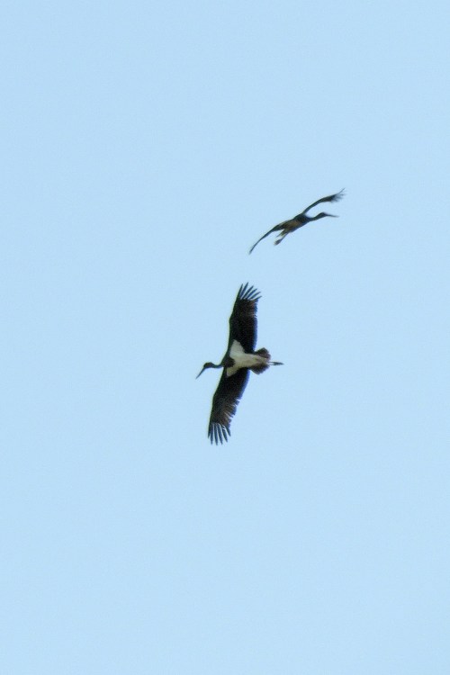
… and a few migrating Black Storks.
Most of the raptors seemed to be travelling along this valley and disappearing from sight …
… we had noticed that a groups of five Egyptian Vultures had appeared from the east and passed up the valley on two occasions, when this happened for the third time we concluded that the same flock must be flying up the west side of the peninsular to the northernmost tip and finding the weather unsuitable for a sea crossing, returning down the east side and going round again and again.
Later on we moved inland where the conditions were better. We headed for a couple of lakes, Abdel Menaami and Sod Melaabi.
Our main target was the rare White-headed Duck, of which we saw a dozen or so, but they were hidden by reeds and quite distant.
The following morning after some initial land birding at Cap Bon we headed off in a small boat to look for seabirds.
The initial plan had been to head for the breeding island of Zembra but the recent wind had resulted in a large swell. So instead we travelled up the east (leeward) side of the peninsula, where as you can see, conditions were excellent.
After a bit of chumming we were soon surrounded by our target birds, Scopoli’s Shearwater (foreground and upper left) and the smaller Yelkouan Shearwater (the remaining five). These species have been split from Cory’s and Manx Shearwater respectively and are both confined to the Mediterranean as breeding birds (a tiny number of Scopoli’s breed in Portugal). I’ve seen both species before but never had views as good as this.
Scopoli’s is slightly smaller than the Atlantic breeding Cory’s but the crucial ID feature which can only be assessed at close range is the white edging to the underwing primaries forming white wedges extending into the otherwise dark primary tips. Cory’s lack this so the white in the ‘hand’ has a more rounded appearance. The two species sound different and according to chromatography studies, smell different too. These two latter features are far more important to a species that identifies its mate in the dark by sound and smell than minor differences in plumage.
The species Manx Shearwater once encompassed all of the Mediterranean taxa, but in recent years Balearic Shearwater (breeding as the name suggests in the Balearic Islands) and Yelkouan (or Levantine) Shearwater have been given specific status. The breeding range of Yelkouan extends eastwards across the Mediterranean from Menorca, where it is marginally sympatric (or possibly hybridises) with Balearic. It is closer in appearance to Manx than Balearic making identification outside of the Med difficult, but has browner undertail coverts and lacks the white curved line behind the ear coverts characteristic of Manx.
Before returning we came in close to the cliffs to see a pair of breeding Peregrines. The most unusual species we saw from the boat was a group of three Pomarine Skuas heading west. It seems unlikely that they wintered in the Med or migrated here via Gibraltar. It was suggested that perhaps they entered the Niger River drainage from wintering grounds in the south Atlantic, crossed the Sahara to the Med and were now heading for the Rhone valley, the Rhine valley, the Baltic and then overland via Lake Lagoda to the White Sea and their arctic breeding grounds!
After the boat trip (I hesitate to call a trip a half mile offshore a ‘pelagic’) we set off for the far north-west of Tunisia where we would stay overnight before crossing into Algeria the next day. The dreadful and tragic terrorist attacks in Tunisia in recent years have, as far as the terrorists are concerned, had the desired effect. Empty and half built hotel and apartments such as this one opposite our hotel are seen all along the coast. Such a loss for the Tunisian economy.
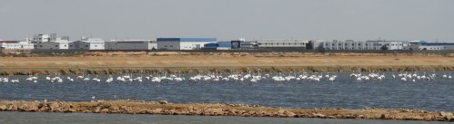
Four days later we were back in Tunisia and all but one of the party were starting the optional extension to the south of the country. After leaving Hammamet near Tunis, our first point of call was these saltpans at Sfax which held a multitude of Greater Flamingos and other birds.
Terns were quite numerous including Little Terns …
… and what I usually refer to as ‘Gullible’ Terns (Gull-billed).
Waders were present in good numbers including Common Ringed Plovers and Little Stints.
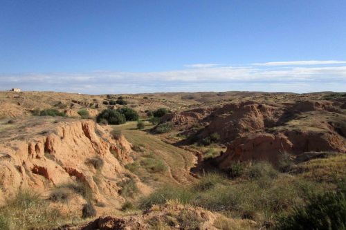
From here we headed southwards and inland for three very enjoyable days birding in the desert.
Soon we reached Bou-Hedma National Park.
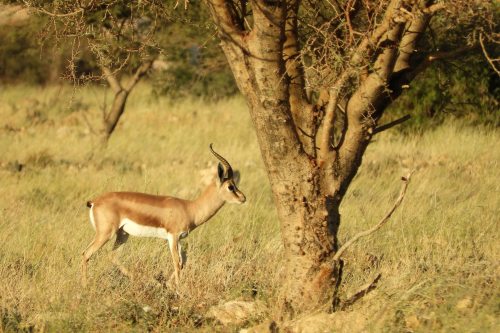
Our targets were both mammalian and avian. This is the widespread Dorcas Gazelle which occurs all across the Sahara and into Sinai and Israel …
… but far rarer is the Addax. This beautiful creature was hunted to extinction in the wild in Tunisia but has now been reintroduced. A few wild individuals exist in Chad, Niger and Mauritania.
Even rarer is the Scimitar-horned Oryx. In this case there are no truly wild individuals left but the species has been reintroduced into Tunisia, Morocco, Senegal and recently Chad. The ones we saw were too far away for decent photos, so this was taken from www.naturetrek.com who also run tours to Tunisia.
Our main avian target was the little known desertorum race of Red-necked Nightjar. Smaller than the nominate race found in Morocco and Iberia, it has been touted as a potential split but apparently the vocalisations are identical.
We stayed at nice hotels in Mahres and Matmata.
Outside of Matmata we stopped in a traditional Berber village.
Views of the surrounding countryside and the local mosque.
It certainly seemed a part of the world where little happens in a hurry.
The scenery became much starker as we journeyed south.
Associated with fens and wetlands in the UK, who would have expected a Swallowtail butterfly in this harsh environment.
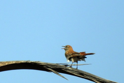
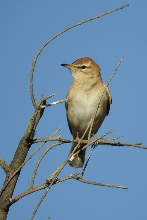
A widespread bird that I seldom see is the lovely Rufous-tailed Bush Robin (a bird that has had more name changes than Italy has had changes in government) but here they seemed quite common with at least eight seen in the area.
Normally shy and skulky, we were able to get some great views.
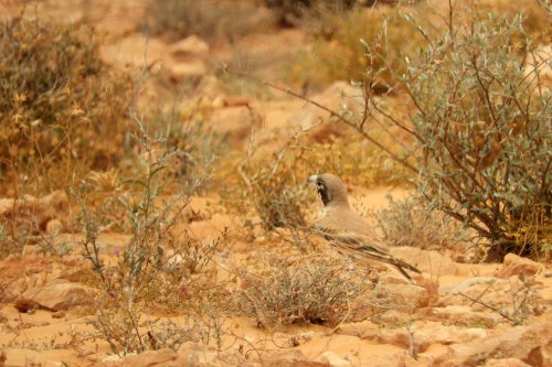
We saw a nice range of larks including this Bar-tailed Lark …
… and most notably a flock of Thick-billed Larks, a species I haven’t seen since I visited Morocco in 1990.
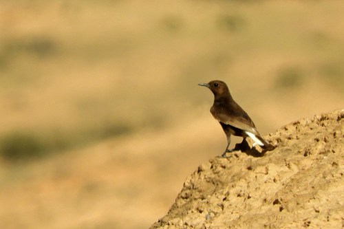
We also saw a total of six species of Wheatear, all of which I photographed with varying degrees of success. Black Wheatear was easily the commonest …
… giving good views throughout the region.
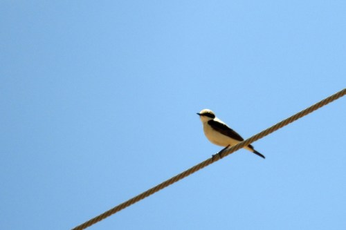
Just a pair of White-crowned Wheatears were seen knocking around this old building.
The western race of Black-eared Wheatear has been identified as a potential split. Apparently the eastern race is more closely related to Pied and Cyprus Wheatear than it is to the western race. So either eastern BE Wheatear should be lumped in with both Cyprus and Pied giving two species overall or all four forms should be given specific rank.
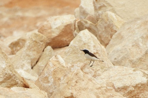
Surprisingly we only saw one Desert Wheatear as in some desert areas its by far the commonest wheatear species.
Another bird I haven’t seen since 1990 is Red-rumped Wheatear, unfortunately hiding its red rump in this shot.
And finally Maghreb Wheatear, a distinctive form of Mourning Wheatear. This form deserves specific status as the primaries are grey, rather than black with white inner webs, and it is sexually dimorphic unlike the nominate race. The scientific name halophila means ‘salt lover’, so presumably it prefers salt flats.
There were plenty of Spanish Sparrows around …
… but took a bit of searching to find the very localised (African) Desert Sparrow.
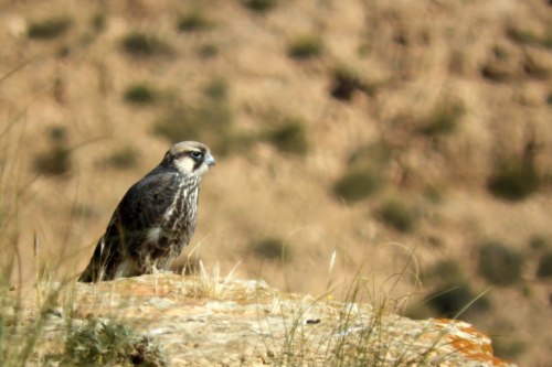
Other goodies included this juvenile Lanner …
… and a rather surprised Little Owl.
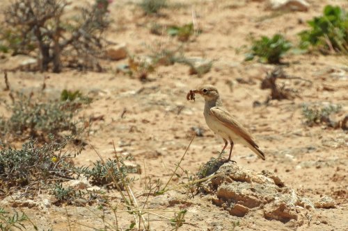
But the best bird of south Tunisia for me was this African Desert Warbler as we missed in in Morocco 19 years ago.
There were some great desert mammals too, the endearing little Gundi …
… and its predator, African Golden Wolf. Recently it has been shown that the Golden Jackals of eastern Europe and Asia are not closely related to the ones in Africa which are in fact related to wolves, so the African populations have been renamed African Golden Wolf.
In due course we left the wild scenery of the south and headed back to Hammamet and an overnight stay before our flights home …
… but on route we took a cultural diversion to El Djem to see one of the best preserved Roman amphitheatres in the world.
From Wikipedia: The amphitheatre was built around 238 AD in Thysdrus, located in the Roman province of Africa Proconsularis in present-day El Djem, Tunisia. It is one of the best preserved Roman stone ruins in the world, and is unique in Africa. As other amphitheatres in the Roman Empire, it was built for spectator events, and it is one of the biggest amphitheatres in the world. The estimated capacity is 35,000, and the sizes of the big and the small axes are respectively 148 metres (486 ft) and 122 metres (400 ft). The amphitheatre is built of stone blocks, located on a flat ground, and is exceptionally well conserved. The amphitheatre of El Jem is the third amphitheatre built on the same place. The belief is that it was constructed by the local proconsul Gordian, who became the emperor as Gordian III. In the Middle Ages, it served as a fortress, and the population sought shelter here during the attacks of Vandals in 430 and Arabs in 647.
The trip to Tunisia along with Algeria had been an excellent short trip with three life birds, a number of potential ticks and some great mammals all set in great scenery.
In spite of uploading photos at a much lower resolution than I would prefer I have now completely run out of available space on this blog. I now have the choice of paying a lot more for additional space, of deleting old posts or reloading old posts with low-res photos. Please bear with me whilst I decide what to do!
Regular readers may have thought that I have given up on updating this blog. I’ve been so preoccupied with foreign travel, ringing birds, writing ringing reports etc that I haven’t had time to edit and file the thousands of photos taken this year, let alone upload them to the blog and write the necessary accounts.
But at long last here is an account of my trip to Algeria in May.
Why you may wonder did I want to go to Algeria? Its not high on most people’s travel wish list! Well for birders there’s always been one very good reason, Algerian Nuthatch, a species only discovered in 1975 and confined to a tiny area of forest in the coastal mountains. North Africa of course is within the Western Palaearctic, ie Europe, North Africa and parts of the Middle East, the area which many European birders consider as ‘home turf’, but civil unrest in Algeria has prevented any hope of a visit for decades.
By 2019 the situation had improved and the Foreign Office was no longer advising against travel to Algeria. Birdquest advertised an ‘expedition’ to Algeria and Tunisia in search of this species and other specialities. I jumped at the chance, as travelling with a tour company would provide security and the knowledge that they would deal with the situation should anything go wrong. Some small private groups have visited using a local guide but I don’t think I could easily get a group together, as none of my friends appear to wish to visit Algeria, or even know if these private tours are strictly legal.
Further examination showed there were a number of other species that were either lifers or potential lifers (should they be split in the future) in both Algeria and Tunisia, making the trip even more worthwhile. As I was away on the West Pacific Odyssey until 15th April and with Easter in the way I worried that my Algerian visa wouldn’t come through in time. In the event it did arrive with days to spare, but three of the ten clients on the trip weren’t so lucky, two didn’t get their visas through before departure and one had his visa application refused and so all were unable to travel.
We flew to Tunis and spent two days in Tunisia before crossing into Algeria. We returned to Tunis after visiting Algeria and then most of the group continued on to southern Tunisia for a four-day optional extension.
In what seems to be a rule left over from the civil war, Algeria doesn’t allow the use of any unauthorised binoculars or telescopes, although bizarrely cameras, including those with telephoto lenses are OK. Our Tunisian guide Mohammed Ali is packing up our optics, which were left in the care of the hotel manager in Tabarka in north-western Tunisia. A few thousand pounds worth of gear in that box!
Crossing into Algeria took three hours of faffing at the border but eventually we were on our way with a police car escort front and back.
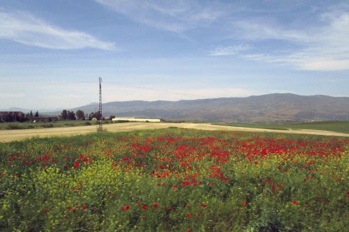
Our journey took us inland through fields adorned with swathes of poppies …
Eventually we reached the coast and headed for the town of Jijel.
Although Algeria must receive very few tourists, the tourist hotel was attractive and the staff welcoming.
The sign means ‘do not flick cigarette butts’ but I prefer to interpret it as ‘no shadow puppets allowed’
There was some coastal scrub in the immediate vicinity of the hotel where we saw some interesting birds like Melodious Warbler …
… and African (or Ultramarine) Blue Tit.
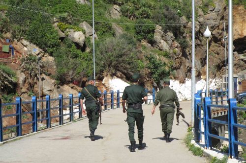
It was clear that we wouldn’t be allowed to go anywhere in Algeria without a police escort, whether this was designed to protect us from the locals or (more likely) to protect the locals from us, wasn’t clear. I guess they thought that we might be attempting to distribute anti-government propaganda. No, we just wanted to see a nuthatch!
By the time we reached the nuthatch site our escort had grown to six police cars and about 18 policemen.
Add to that three forestry officials (including the top boss), two nuthatch researchers (the only locals that we needed as they knew where the birds were), two journalists and a photographer. If you include Tunisian guide Mohammed-Ali and Mark from Birdquest that means 26 people are needed to get seven clients onto the bird!
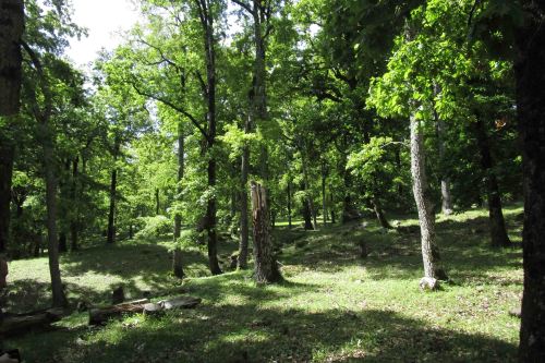
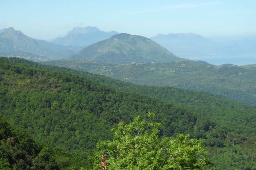
Much of the Kabylie mountains are deforested, which is why the Algerian Nuthatch is considered endangered, but some forest areas remain.
Our first stop was in Djimla Forest, mainly Algerian Oak with some Algerian Fir and Atlas Cedar.
The forest holds many birds that would be found in deciduous forests in Europe, like this Hawfinch …
… but also some North African specialities such as this Atlas Flycatcher. My only birding visit to the Mahgreb region was in January 1990 so summer migrants like this species weren’t around at that time of year.
It wasn’t long until we were shown a pair of Algerian Nuthatches. Smaller than the familiar Eurasian Nuthatch, the main distinguishing feature is the black fore-crown. From Wikipedia: It was first discovered on October 5, 1975, at the Djebel Babor in the Petite Kabylie range in northern Algeria, by a team led by a young Belgian agronomist Jean-Pierre Ledant. The Algerian Nuthatch is a resident bird of five areas of mountain forest in northeast Algeria, with the fifth breeding site just discovered in spring 2018. Its range is limited by the availability of woodland, and it occurs only above 1,000m, with the population density increasing with altitude.
After enjoying some time with the nuthatches we returned to the hotel. The birds were quite unconcerned with our presence and we had decent naked-eye views and via our cameras. The forestry guys had a couple of old pairs of bins but using them was like looking though the bottom of a milk bottle.
The hotel was on the beach with a nearby stream that held the occasional wader like LRP.
Once again we couldn’t go anywhere without the police (they had even confiscated the driver’s driving licence) and that afternoon they just decided to not bother turning up. So we were stuck to the immediate vicinity of the hotel where all we could do is wander round and photograph common species like Spanish Sparrow and listen to the Nightingales.
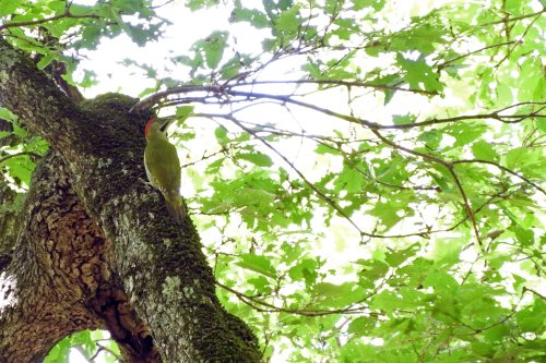
However one bird we found around the hotel was most noteworthy. This is the numidus race of Great Spotted Woodpecker which differs from the European races by the thick black, red-tinged breast band and a degree of red suffusion on the belly. When you consider how close Levaillant’s (Green) Woodpecker and Iberian (Green) Woodpecker are to European Green Woodpeckers then it is most surprising that this form hasn’t been split.
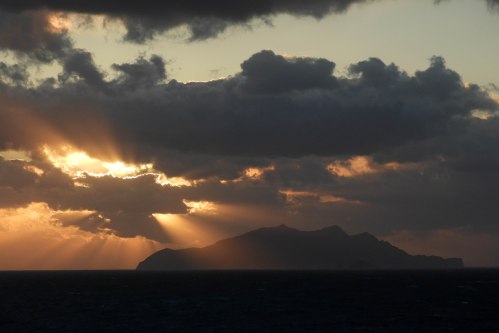
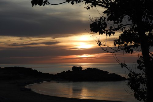
The day ended with a lovely sunset seen from the hotel.
The following morning (once the police escort had arrived) we set off down the coast.
Our main target was to see Barbary Macaques, truly wild ones unlike the introduced animals on Gibraltar.
I was surprised to find singing Iberian Chiffchaffs along the coast as I thought they only occurred in western Iberia and south-westernmost France. Later on we saw and heard the so-called ‘Ambiguous’ Reed Warbler, a race of African Reed Warbler that breeds in the Western Palaearctic.
We then headed back into the mountains to another forested area, Taza National Park.
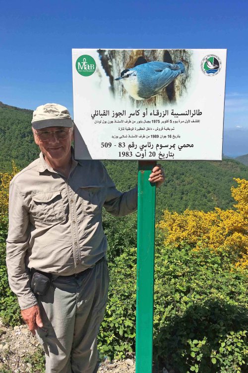
The sign says the area was designated in 1983 to protect Algeria’s only endemic bird which was first described from here (not sure about the ‘from here’ bit) in 1975.
It was an extensive area of forest with rather more fir and cedar among the oaks than Djimla.
As well as more nuthatches we had excellent views of Levaillant’s Woodpecker …
… a displaying male Firecrest …
… the yellow-breasted ledouci race of Coal Tit …
… and most importantly the mauritanica race of Tawny Owl which has been posted as a potential split on the IOC website since we returned. As well as having excellent views the bird sang for us giving a great opportunity to compare the vocalisations.
Later we wandered back down the road seeing a few more birds such as Subalpine Warbler of the north African race inortata.
The following morning we waited for our police escort to take us to the border. Having ascertained that the driver had been given his licence back we decided that they were no longer bothered with us and we set off without them.
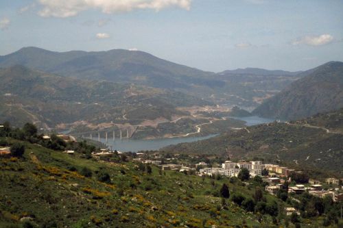
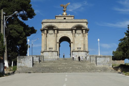
This gave us the chance to stop at the lovely city of Constantine. As well as admiring the view we were able to add Pallid and Alpine Swift and the Algerian race cirtensis of Western Jackdaw to our list. From Wikipedia: Constantine is situated on a plateau at an elevation 640 metres (2,100 ft) above sea level. The city is framed by a deep ravine and has a dramatic appearance. The city is very picturesque with a number of bridges over Rhumel River and a viaduct crossing the ravine. The ravine is crossed by seven bridges, including Sidi M’Cid bridge.
From this arch …
… we obtained great views over the surrounding countryside.
From here there was little to do but drive to the border (formalities weren’t as bad on the way out), pick up our optics and have lunch at the hotel in Tabarka and head for Hammamet, just south of Tunis. Here one of the party left to fly home and the rest of us stayed overnight for the extension to southern Tunisia.
I know its corny …
… but lets end with another couple of shots from the hotel at Jijel.
Algeria had been a short but very interesting trip. I obtained two life birds with a few more as insurance against future taxonomic change. The difficulties of birding with a police escort and without optics are obvious and I picked up a nasty bout of food poisoning, but all in all, I’m very glad I took the opportunity to join this tour.
The next post will deal with our experiences in Tunisia.