THIS POST, IRELAND PART 3, WAS UPLOADED IN NOVEMBER 2019. FOR REASONS UNKNOWN TO ME MOST OF THE PHOTOS ON THIS BLOG POST DISAPPEARED AND I HAD TO REDO THEM. CHANGES HAVE OCCURRED IN THE FORMAT OF BLOG POSTS IN THE INTERIM AND THE PHOTOS APPEAR MUCH LARGER THAN THOSE IN OTHER POSTS. ALSO I MAY NOT HAVE CORRECTLY CAPTIONED ALL THE PHOTOS AS I AM REDOING IT FROM MEMORY, SO IF YOU KNOW THESE SITES AND I HAVE INCORRECTLY DESCRIBED THEM PLEASE ACCEPT MY APOLOGIES.
After our time in Donegal we drove south to Sligo where we spent the night and then continued on along the coasts of Co Sligo, Co Mayo and Co Galway. After returning to Dublin we took the ferry to the Isle of Man where we stayed overnight before returning to Dorset.
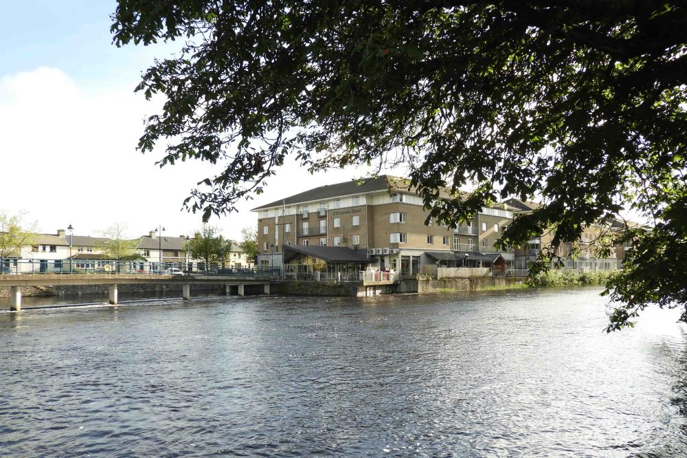
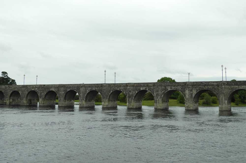
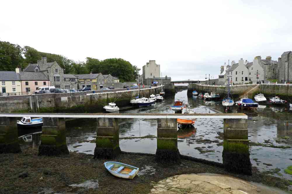
The hotel by the river in Sligo.
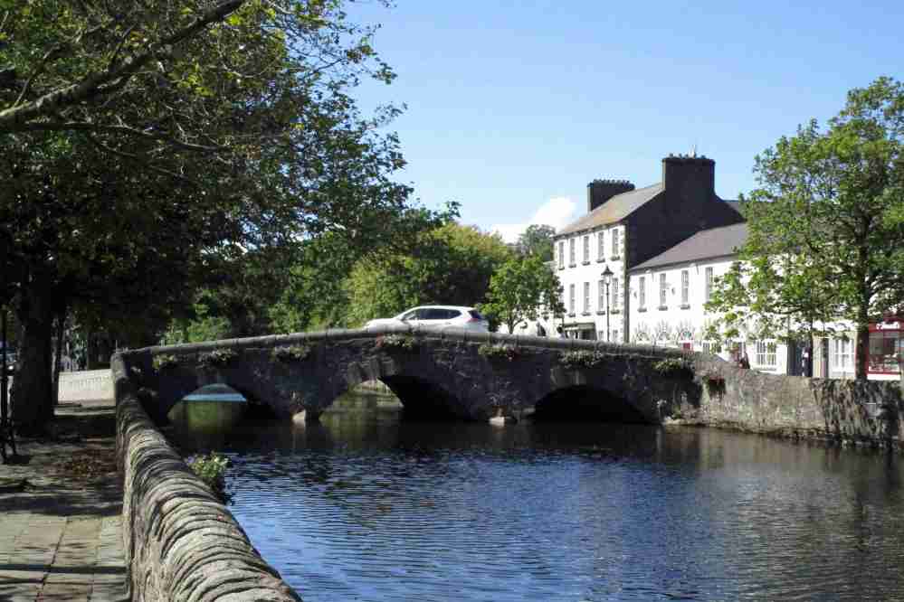
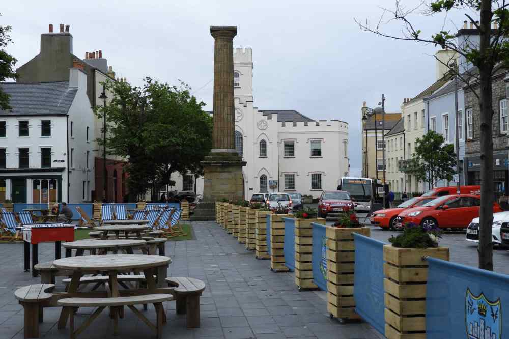
A walk in the town


We drove along the north coast of Co Sligo, passing a number of old forts. The scenery was interesting but not stunning …

… but further along in Co Mayo the scenery became more dramatic …

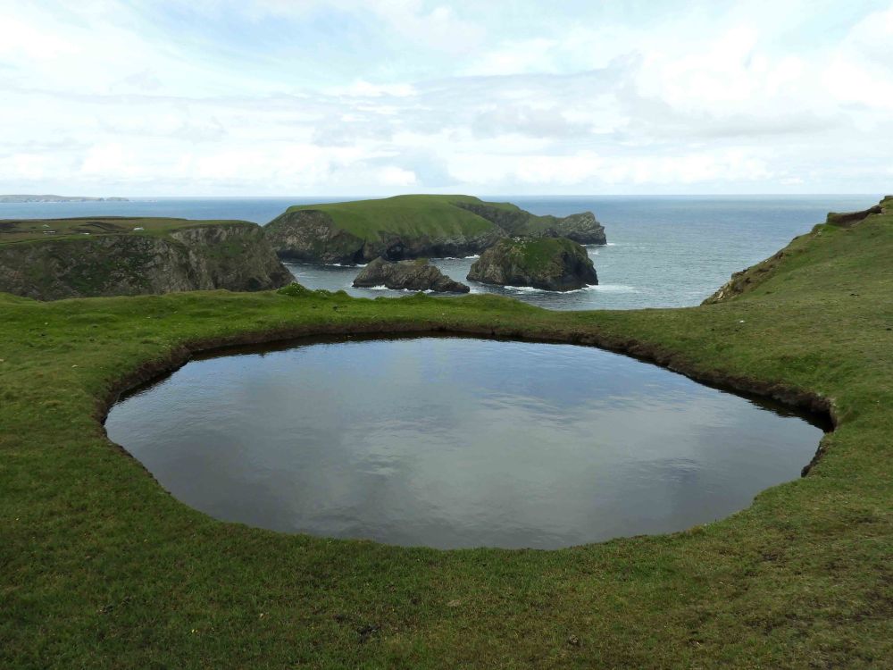
… with beautiful coves …


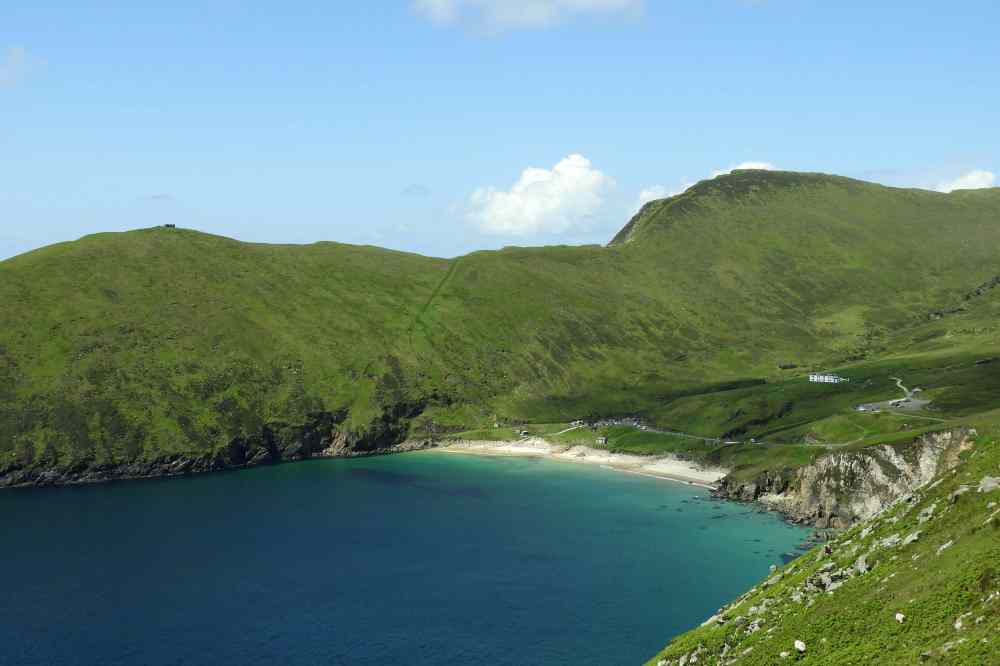
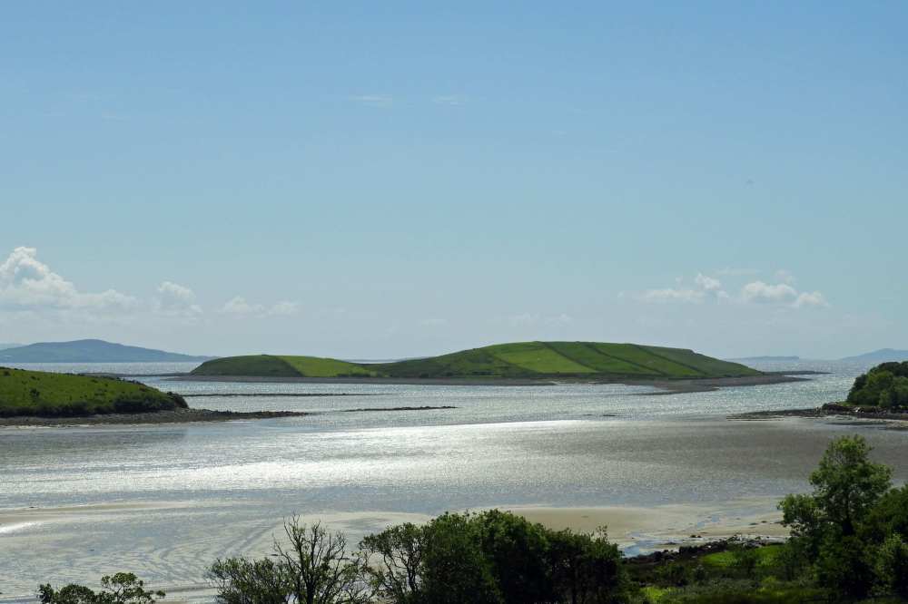
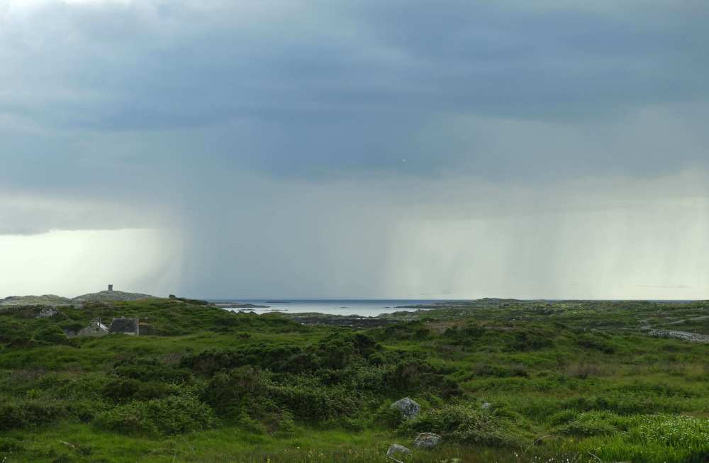
… and dramatic loughs and distant mountains.


We stayed the night in Belmullet and spent the evening exploring the beautiful Belmullet peninsula.


Next day we drove to Achill Island and headed for the westernmost point.

On route I noticed a number of swans on a roadside lough, one didn’t look quite right so I stopped and my suspicions were confirmed. It was indeed a Whooper Swan. This winter visitor from Iceland is quite common in Ireland in winter but it is very rare in summer. Possibly this is an injured bird that was unable to migrate, although I checked the lough again as we left and it wasn’t there, so presumably it was capable of flying.
The road didn’t go all the way to the western tip and it was too far to walk within the time we had available. However the views from the cove at the end of the road …


… looking southwestwards towards Toremore Island and the Galway coast beyond were outstanding.


The wonderful scenery continued as we returned eastwards.

Between Newport and Westport the main roads runs north – south. Offshore are a multiplicity of islands but getting to see them is very difficult. On our visit in 1991 we stayed at a B&B nearby and we were given directions to a great viewpoint. However as hard as we tried we were unable to repeat this experience, we drove down many narrow roads to farms but all ended up as private dead ends
.We stayed overnight at Murrisk and were able to get another perspective on the islands from the south.


The view from the village was dominated by this bare-flanked mountain.

At Louisburg we climbed over the peninsula …
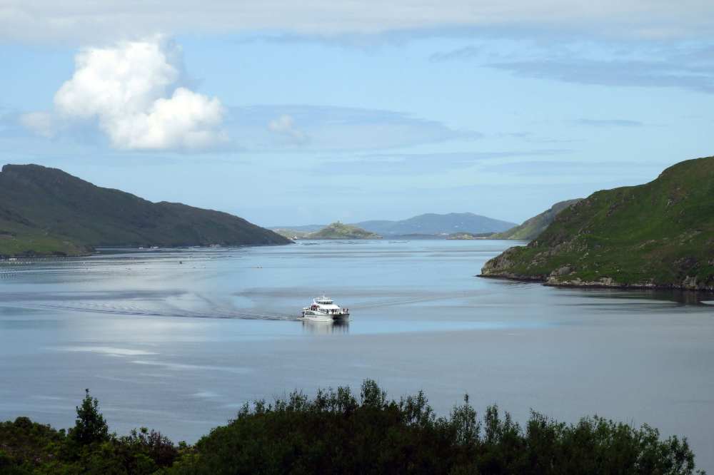
… before dropping down south towards Killary Fjord, Ireland’s only true sea fjord …

… we stopped at the lovely Aasleagh Falls …

… before heading up the south side of the fjord.


On route we stopped to photograph the lovely Kylemore Abbey.

South of Killary Fjord the trip took on a different dimension. Once past the Giant’s Causeway and the Dark Arches we had seen virtually no tourists and the roads only held local traffic.

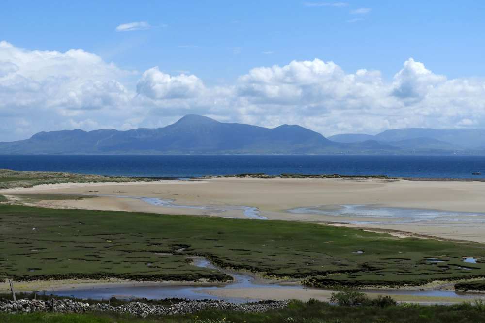
Now there were tourist busses and kiosks selling leprechauns and other souvenir trinkets. Heading south past Connemara NP we took a side road to the coast to get away from mass tourism and encountered some wonderful beaches …

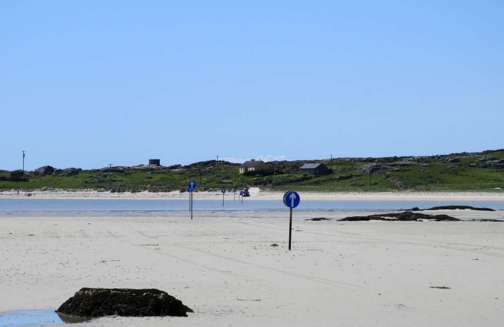
… this one with a marked route that allows you to cross to a nearby island at low tide.

Moving on again, now to the west, we passed the the mountain range known as the Twelve Pins.

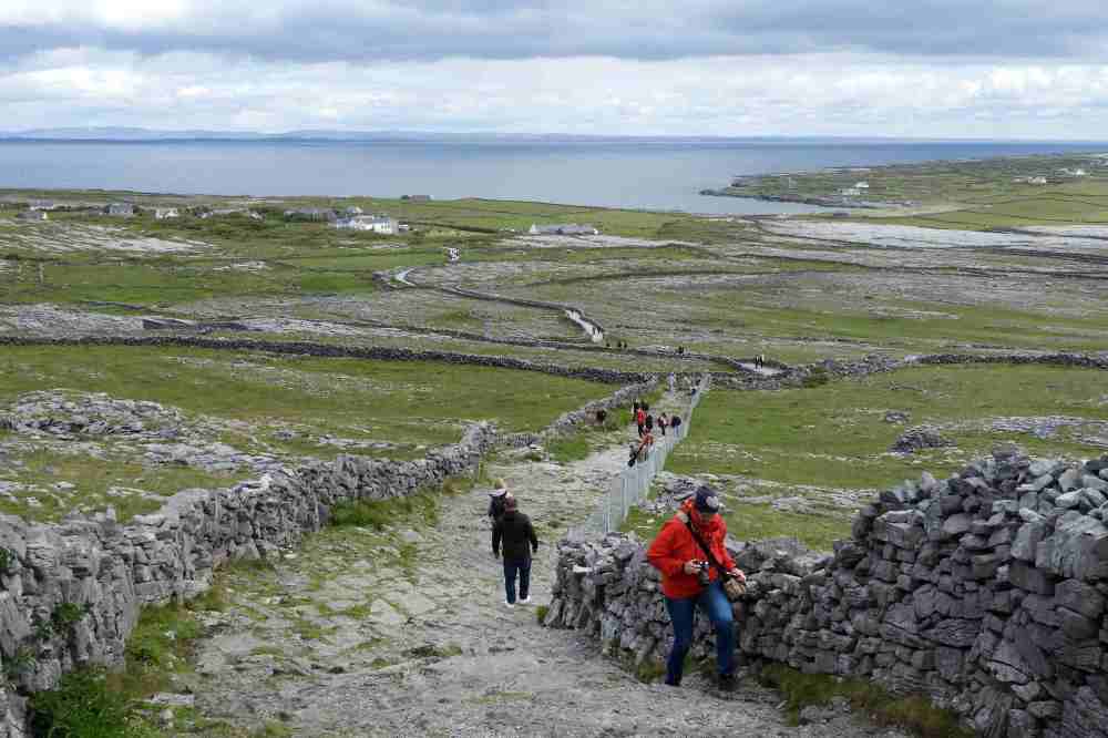
Finally we ended up well to the south at Rossaveal, the start point of our ferry to the Aran Islands. We found a B&B without too much difficulty but finding a restaurant took much longer. We also followed a series of causeways which took us to five low-lying islands (see above) over the course of a thirty-minute drive.


I had wanted to visit the island of Inisbofin (mainly I think because it has hosted a few rare birds, not that any would be there in June) but Margaret wanted to go to the Aran Islands. These comprise of three islands, Inishmore, Inishmaan and Inisheer and we chose to visit the largest island, Inishmore.

There is quite a lot of ‘traditional’ transport on the island.
![]()

From Inishmore we had great views across the sea to the Twelve Pins mountain range. The Aran Islands are politically part of Co Galway but geologically are part of Co Claire. The landscape is more typical of the limestone pavements of the Burren than the largely granitic Co Galway.

We were heading for the ancient fort of Dún Aonghasa, situated on a cliff 100m above the sea on the south side of the island.

From Wkipedia: It is not known exactly when Dún Aonghasa was built, though it is now thought that most of the structures date from the Bronze Age and Iron Age. Excavations at the site indicate that the first construction goes back to 1100 BC, when the first enclosure was erected by piling rubble against large upright stones. Around 500 BC, the triple wall defences were probably built along the western side of the fort. The 19th-century artist George Petrie called Dún Aonghasa “the most magnificent barbaric monument in Europe”. Its name, meaning “Fort of Aonghas”, may refer to the pre-Christian god of the same name described in Irish mythology, or the mythical king, Aonghus mac Úmhór. The fort consists of a series of four concentric walls of dry stone construction, built on a high cliff some one hundred metres above the sea. At the time of its construction sea levels were considerably lower and a recent documentary estimates that originally it was 1000 metres from the sea. Surviving stonework is four metres wide at some points. The original shape was presumably oval or D-shaped but parts of the cliff and fort have since collapsed into the sea. Outside the third ring of walls lies a defensive system of stone slabs, known as a cheval de frise, planted in an upright position in the ground and still largely well-preserved. These ruins also feature a huge rectangular stone slab, the function of which is unknown. Impressively large among prehistoric ruins, the outermost wall of Dún Aonghasa encloses an area of approximately 6 hectares. Photo from visitgalway.ie

I crept on my belly to the edge of the cliff and had dizzying views down to the sea far below.

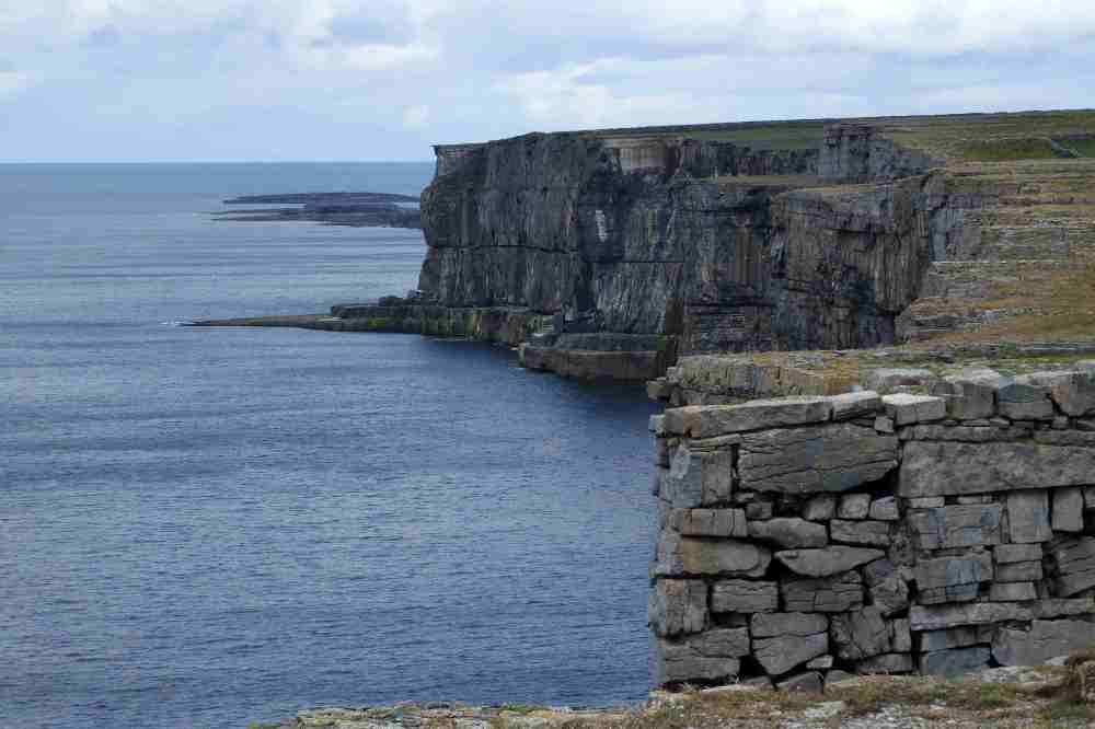
The wall forms the perimeter of the fort but the steep cliffs continue on as far as the eye can see.

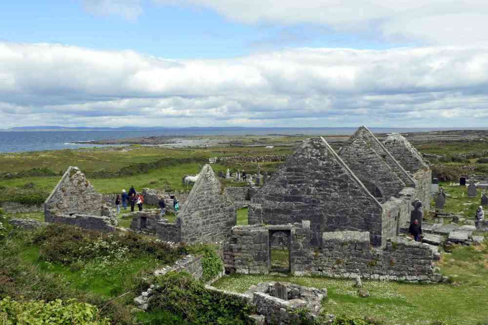
We also visited a group of seven ancient (7th or 8th century) churches, each dedicated to a different saint.


Margaret at one of the churches.

We aimed to finish our tour around the coast at the City of Galway because from here it is a fairly short drive on the motorway back to Dublin. It was raining that morning and we decided not to bother with a visit to the city but press on eastwards. We stopped for a break at Shannonbridge which, hardly surprisingly, ‘does just what it says on the tin’. After some difficulty with the road system in Dublin we found a hostel near to the docks which was OK but was probably the least salubrious of all the places we stayed in Ireland. The following morning we caught the ferry to Douglas in the Isle of Man.

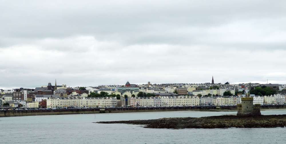
In 2018 on a tour to Mongolia I met Tim Earl and Liz Charter who live in the Isle of Man. We contacted them ahead of our visit and asked if we could meet up somewhere for a drink. They kindly said we must stay with them and they would show us around. This our view of Douglas as the ferry approached.
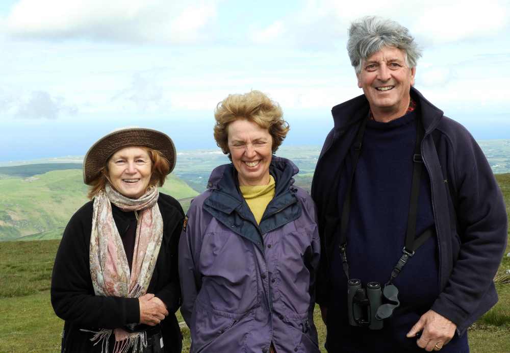
Here’s Margaret with Liz and Tim at the top of a very windy Snaefell, the highest point of the island.
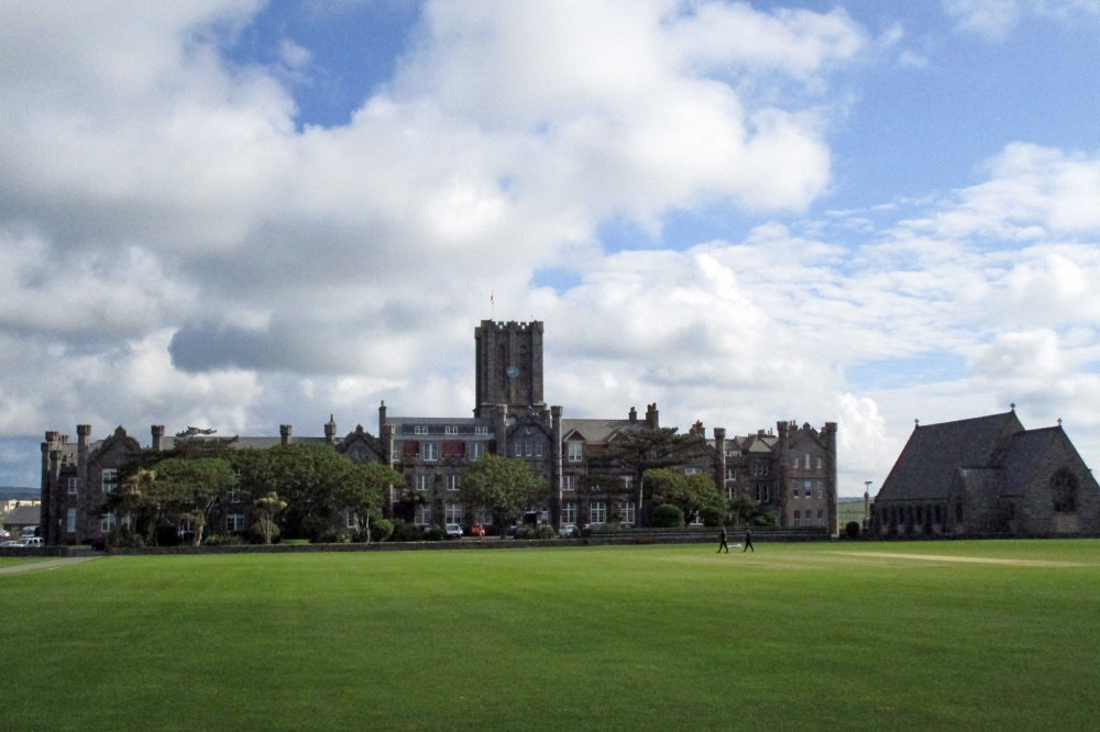
Near their house was this public (ie private) school looking like something out of Hogworts.

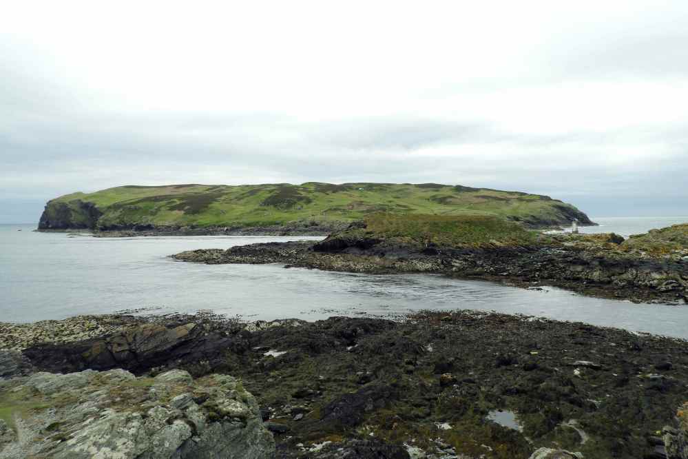
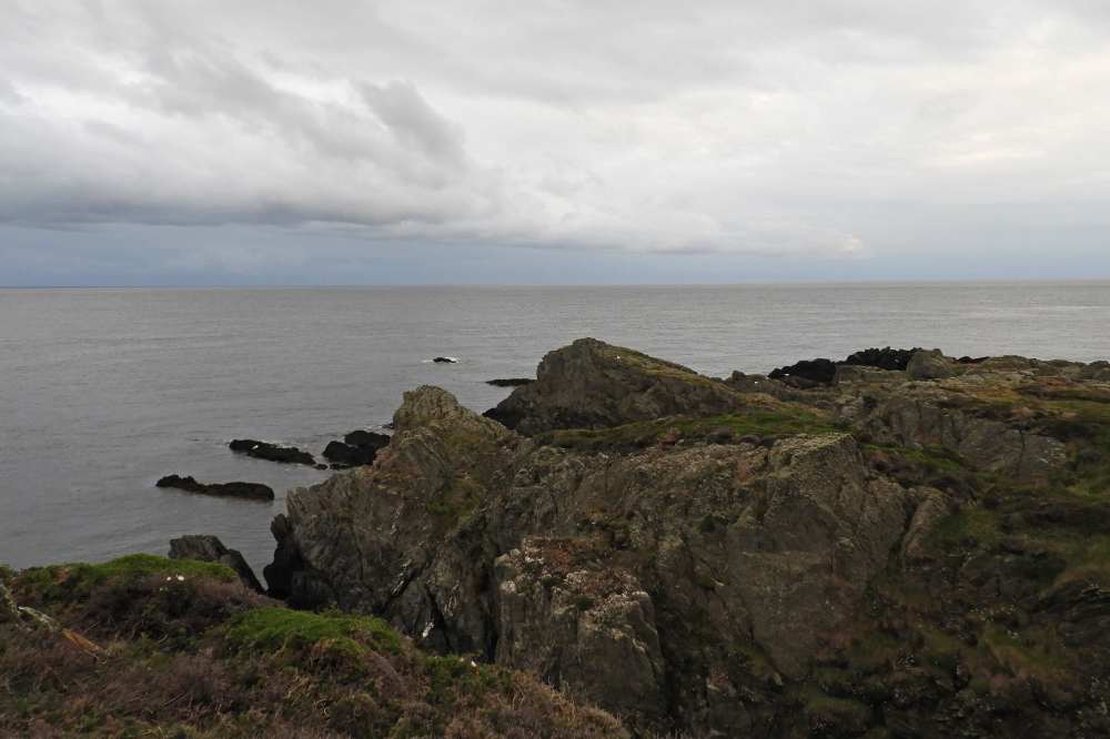
Tim and Liz took us to the southernmost tip of the island which overlooks the the offshore island known as the Calf of Man. This is a site of a Bird Observatory and is known for attracting a good number of rarities as well as having a lot of breeding seabirds.
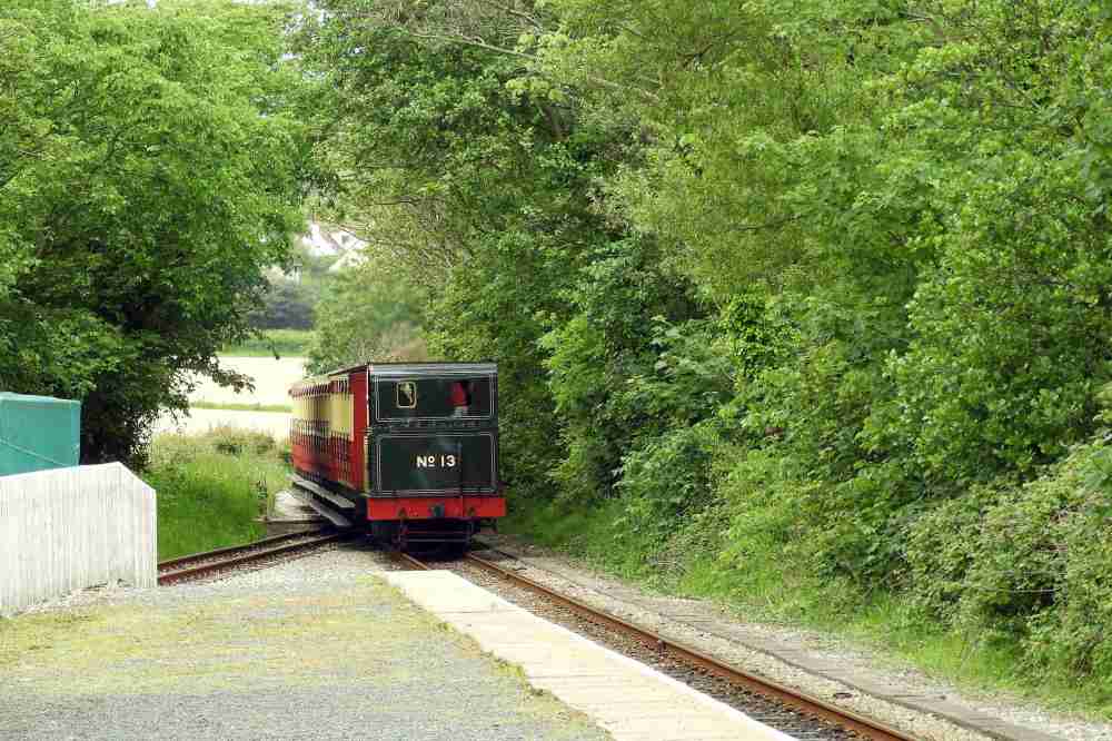
Whilst Liz had other things to attend to Tim, Margaret and I caught the steam train back to Castletown where my car was parked.
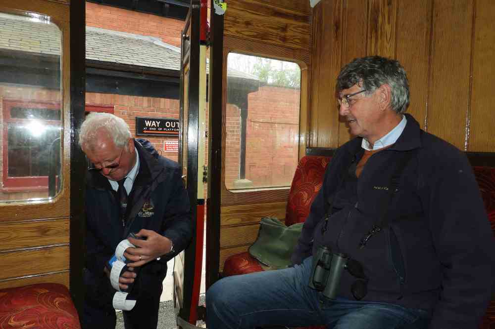
An old fashioned steam train complete with an old fashioned ticket collector.
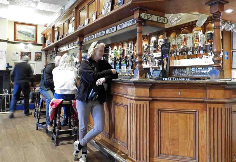
Tim insisted that you can’t ride the steam train without a stop in the Railway Siding pub at the other end. Who were we to disagree?

Here is the Castle Rushen in Castletown. The Isle of Man is a self- governing British dependency. It is claimed that the Manx government, known as the Tynwald has been in continuous existence since 979. (The Tynwald is of course situated in Douglas not Castletown).

Castletown has a pretty little harbour.
Another view of Castletown.
In the evening we went for a walk to Dreswick Point. Although it was still early June there was evidence of the first returning waders with both Curlew and Whimbrel seen. Most appropriately we saw a single Manx Shearwater (although first described from the Calf of Man the species is now a rare there although increasing after a de-ratting program).


The scenery was quite dramatic with views southwards towards Anglesey in north Wales.

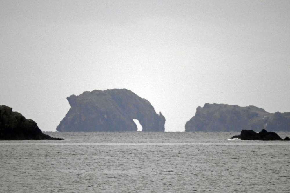
An offshore rock is known locally as the ‘Drinking Dragon’.

The following morning Tim and Liz took us to Laxey where we caught the tram to the highest point of the island, Snaefel at an altitude of 621m.

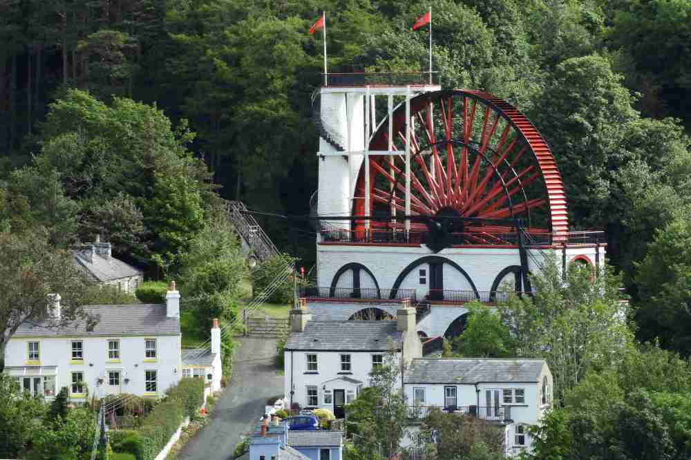
The Laxey Wheel (also known as Lady Isabella) is the largest working waterwheel in the world and was built in 1854 to pump water from nearby mines. The wheel is 22m in diameter.


The tram slowly climbs the mountain passing and crossing sections of the famous TT circuit.

The view from the (very windy) top was great but it was rather misty. On a clear day you can see from the Mull of Galloway in Scotland right all the way round the Solway Firth, the Lake District, the Lancastrian coat, north Wales and Anglesey and to the west, from the Wicklow mountains of Eire to the hills of Antrim. In spite of the haze you could still see Scotland, England, Wales and Northern Ireland through the binoculars.

There was some delay in returning as there was a cruise liner in Douglas harbour and the cruise passengers were given priority in boarding the trams, so after a rather chilly wait at the top we descended and lunch in a pretty beach shack near Douglas …

… before visiting Marine Drive just south of the capital. A landslide has closed one end of this scenic route so now it gets far less traffic and a family of Peregrine Falcons has taken to sitting on the road. We had great views of the two adults and three juveniles (as seen above) before it was time to say our goodbyes to Tim and Liz and head for the 3pm ferry to Liverpool.

At the ferry we had a shock, even though we had used identical details in booking the Douglas -Liverpool ferry as we had (with the same company) to book the Dublin – Douglas one, we were only booked on as foot passengers. Fortunately there was space for our car although the additional cost was eye-wateringly high. We arrived at the Liver Building at Liverpool in the rush hour and got stuck in some dreadful traffic jams getting out of the city. We arrived home in Dorset before midnight.
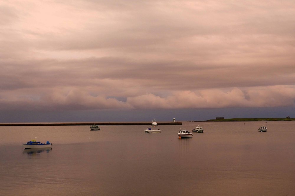
It had been a great trip with fascinating history, good birds and wonderful scenery – all relatively close to home. I’ll conclude with this stunning view of the sunset at Derbyhaven harbour taken from Tim and Liz’s apartment.

We would like to return to Ireland in the not too distant future. Perhaps we will take the ferry to Dublin from Anglesea, drive to Galway and then head south to the cliffs of Moher, the Burren in Co Clare before heading to the Kilarney area before heading to Rosslare via Cork and Waterford. Time will tell if we ever get round to it.

Leave a comment